File:Baikonur tilemap.gif
Jump to navigation
Jump to search
No higher resolution available.
Baikonur_tilemap.gif (626 × 494 pixels, file size: 61 KB, MIME type: image/gif)
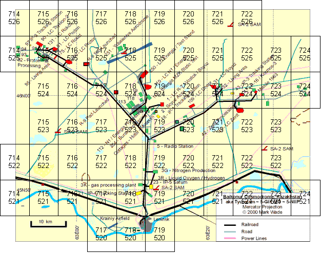
Rough overview of the surface tiles needed for Project Baikonur. top number is longitude index, lower number is latitude index for each tile.
File history
Click on a date/time to view the file as it appeared at that time.
| Date/Time | Thumbnail | Dimensions | User | Comment | |
|---|---|---|---|---|---|
| current | 14:39, 20 August 2006 | | 626 × 494 (61 KB) | Urwumpe (talk | contribs) | Rough overview of the surface tiles needed for Project Baikonur. top number is longitude index, lower number is latitude index for each tile. |
You cannot overwrite this file.
File usage
The following page uses this file: