SRTM
Jump to navigation
Jump to search
The printable version is no longer supported and may have rendering errors. Please update your browser bookmarks and please use the default browser print function instead.
The Shuttle Radar Topography Mission was a two week STS mission for creating high-res SAR topography maps of most of earths surface.
| STS-99 | |||||||||||||
|---|---|---|---|---|---|---|---|---|---|---|---|---|---|

| |||||||||||||
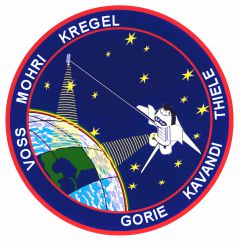
| Mission patch | |||||||||||||
| Spacecraft | |||||||||||||
| {{{craft}}} | |||||||||||||
| Objectives | |||||||||||||
| Flight | STS-99 | ||||||||||||
| Mission | SRTM | ||||||||||||
| Duration | 10 days | ||||||||||||
| Crew | |||||||||||||
| |||||||||||||
| Experiments | |||||||||||||
| SRTM, EarthKAM | |||||||||||||
| Launch | |||||||||||||
| Liftoff time | February 12, 2000 17:43 UTC | ||||||||||||
| Launch complex | LC 39A | ||||||||||||
| Launch center | KSC | ||||||||||||
| Launch crew | Kregel, Gorie, Kavandi, Voss, Mohri, Thiele | ||||||||||||
| Initial Orbit | |||||||||||||
| Inclination | 57° (eq) | ||||||||||||
| Perigee altitude | 220 km | ||||||||||||
| Apogee altitude | 245 km | ||||||||||||
| Landing | |||||||||||||
| Landing time | February 22, 2000 23:23 UTC | ||||||||||||
| Landing location | KSC Rwy 33 | ||||||||||||
| Landing crew | Kregel, Gorie, Kavandi, Voss, Mohri, Thiele | ||||||||||||
| Mass properties | |||||||||||||
| {{{massprop}}} | |||||||||||||
Getting SRTM data sets
SAR data sets are a good source if you are interested into making quality 3D terrains for Orbiter.
You can download SRTM data from this location. [1]
SRTM addons
The mission can be recreated using the SRTM addon by No Matter, which is available from Mustard's website[2].