Difference between revisions of "File:Baikonur tilemap.gif"
Jump to navigation
Jump to search
(Rough overview of the surface tiles needed for Project Baikonur. top number is longitude index, lower number is latitude index for each tile.) |
(No difference)
|
Revision as of 14:39, 20 August 2006
Rough overview of the surface tiles needed for Project Baikonur. top number is longitude index, lower number is latitude index for each tile.
File history
Click on a date/time to view the file as it appeared at that time.
| Date/Time | Thumbnail | Dimensions | User | Comment | |
|---|---|---|---|---|---|
| current | 14:39, 20 August 2006 | 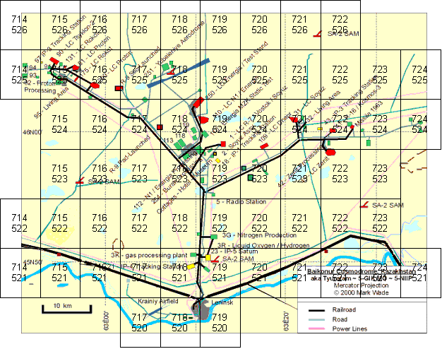 | 626 × 494 (61 KB) | Urwumpe (talk | contribs) | Rough overview of the surface tiles needed for Project Baikonur. top number is longitude index, lower number is latitude index for each tile. |
You cannot overwrite this file.
File usage
The following page uses this file: